Puno Maps

Home / Puno Info / Puno Maps

Puno & Lake Titicaca: Maps & Geography

Perched at 3,830 meters (12,566 feet) above sea level on the shores of Lake Titicaca, Puno occupies one of the most strategic and spectacular locations in the Peruvian Andes. Understanding the geography of this unique region will help you plan your journey through the altiplano and across the world’s highest navigable lake.

Puno in Peru: Gateway to the Altiplano

Situated in southeastern Peru along the Bolivian border, Puno serves as the capital of its namesake department and sits at the northwestern edge of Lake Titicaca.

The city lies approximately 1,300 kilometers (808 miles) southeast of Lima, making it one of Peru’s most remote major destinations—yet this isolation has preserved its authentic Andean character and made it a crucial crossroads for travelers exploring the southern Peruvian highlands.

The region occupies a unique position as the cultural and geographic heart of the altiplano, the vast high-altitude plateau shared by Peru and Bolivia. From Puno, the majestic snow-capped peaks of the Cordillera Real in Bolivia are visible across the lake on clear days, a constant reminder of the international character of this remarkable landscape.

Outline map of Peru with the Puno region highlighted in dark brown, located in the southeastern part of the country, bordering Bolivia and Lake Titicaca.

To book your Puno tours now or consult with us, fill out the “Contact Us” form and a Fertur Peru Travel coordinator will contact you within one working day with detailed information about your fully customizable trip.


Fertur Peru Travel’s pledge is to offer you top-quality, individualized attention that starts with the planning of your trip and continues through your journey to guarantee a great vacation.

Transportation Hub: Connecting Peru's Highland Treasures

Strategic Access to Major Destinations

Puno functions as an essential transit point connecting three of Peru’s most important tourist destinations. To the northwest lies Cusco (390 kilometers/242 miles), the gateway to Machu Picchu and the former Inca capital. To the southwest sits Arequipa (297 kilometers/185 miles), Peru’s elegant “White City” and starting point for Colca Canyon adventures.

Puno Map - Routes to Cusco, Arequipa, Tacna/Moquegua and Bolivia

The Legendary Andean Explorer Train

One of the most spectacular ways to reach or depart Puno is aboard the luxurious Andean Explorer, Peru’s only luxury sleeper train. This magnificent train between Cusco and Puno traverses the altiplano’s dramatic landscapes, crossing La Raya Pass at 4,321 meters (14,177 feet)—one of the highest railway points in the Americas. The ten-hour route transforms travel into an experience itself, with panoramic windows revealing snow-capped peaks, traditional villages, and herds of alpacas and vicuñas. The route can be extended to Arequipa, creating a three-day rail odyssey through the Peruvian Andes.

Overland Routes

For travelers preferring road transportation, comfortable tourist buses connect Puno with both Cusco and Arequipa daily. The Cusco route typically includes stops at significant archaeological sites like Raqchi and Andahuaylillas, transforming the drive into a cultural experience. The Arequipa route offers stunning views of volcanic landscapes and altiplano scenery.

Air Access

While Puno itself has a small airport with limited service, most visitors fly into Juliaca’s Inca Manco Cápac International Airport, located just 45 kilometers (28 miles) north. Daily flights connect Juliaca with Lima, Cusco, and Arequipa, making Puno readily accessible despite its remote location. The drive from Juliaca to Puno takes approximately one hour through characteristic altiplano landscape.

Best for: understanding Puno’s location relative to Cusco, Arequipa, and major transportation routes; planning multi-destination itineraries in southern Peru.

Planning notes: The Andean Explorer train requires advance booking (especially May-September). Bus journeys to Cusco (6-7 hours) and Arequipa (5-6 hours) are scenic but long; morning departures offer better views. Juliaca airport transfers take 45-60 minutes; arrange pickup in advance as taxis can be scarce.

Related: Puno tours | Cusco tours | Arequipa tours

Lake Titicaca: Gateway to Bolivia

Lake Titicaca’s international character makes Puno an ideal starting or ending point for travel between Peru and Bolivia.

The lake itself is shared between the two nations, with approximately 60% in Peru and 40% in Bolivia, creating unique opportunities for cross-border exploration.

Best for: planning your Peru-to-Bolivia crossing route and understanding border logistics before you travel.

Planning notes: Border crossings require valid passports; exit stamps from Peru and entry stamps for Bolivia are mandatory at land borders. Currency exchange is available at borders but rates are better in cities. Bus journeys to La Paz involve high-altitude travel (3,600-4,000 meters/11,800-13,100 feet); acclimatize in Puno first. Water crossings take longer but offer spectacular scenery and island visits.

Related: Bolivia Entry Requirements 

Detailed bilingual map of Lake Titicaca showing the Peruvian and Bolivian shores, key towns including Puno, Juliaca, Copabacana, and La Paz, main islands such as Isla Taquile, Isla Amantaní, Isla del Sol, and Isla de la Luna, distances between destinations, transport connections, and general lake data including elevation of 3,810 m.a.s.l., total surface area of 8,560 km², maximum depth of 280 m, and maximum length of 172 km.

The Islands: Cultural Encounters Beyond the Tourist Trail

Detailed map of the Puno area and the Peruvian shore of Lake Titicaca, showing the floating islands of Uros, Isla Taquile, Isla Amantaní, Isla Tikonata, and the communities of Llachón, Luquina, and Karina, along with the Lake Titicaca National Reserve, Sillustani, Laguna Umayo, and road connections between Puno, Juliaca, Chucuito, and Capachica.

Beyond Uros, Taquile & Amantaní: Discovering Lake Titicaca's Hidden Gems

While the Uros Floating Islands, Taquile, and Amantaní have rightfully earned their place as Lake Titicaca’s most famous destinations—offering authentic cultural experiences with welcoming communities who maintain ancestral traditions—each brings something distinctive to visitors.

The Uros demonstrate their remarkable floating reed island construction and boat-building techniques. Taquile’s men create UNESCO-recognized textiles and the island offers stunning panoramic views.

And Amantaní provides overnight homestays where families share their agricultural lifestyle and lead visitors to hilltop temples for sunset ceremonies. 

Yet beyond these well-established circuits, the lake harbors numerous other islands and peninsular communities that provide equally rewarding, often more intimate cultural encounters with fewer fellow travelers and even deeper connections to traditional Andean ways of life.

Best for: choosing which Lake Titicaca islands to visit based on your interests and deciding between popular or off-the-beaten-path community experiences.

Planning notes: Uros, Taquile, and Amantaní can be visited on organized tours from Puno; alternative islands like Tikonata, Llachón, and Anapia typically require advance homestay arrangements through community tourism organizations. Island homestays involve basic accommodations, shared meals, and participation in daily activities—pack warm layers, sun protection, and any personal medications. Respect local customs: ask permission before photographing people, dress modestly, and bring small gifts for host families (school supplies, fresh fruit).

Related: Puno Highlights Guide

Alternative Titicaca Experiences

Isla Tikonata has emerged as an exciting alternative for travelers seeking genuine community-based tourism. This small island near the Capachica Peninsula offers homestay experiences where visitors participate in daily activities like fishing, farming, and textile creation with local families, often without encountering other tourists.

Llachón, located on the Capachica Peninsula, provides another outstanding option for cultural exchange. This traditional farming and fishing community of approximately 1,300 inhabitants has organized homestay programs where visitors stay with local families, share meals, learn traditional crafts, and help with agricultural tasks—all while enjoying spectacular lake views and access to secluded beaches.

Isla Anapia, located near the Bolivian border in the Wiñaymarca archipelago, offers one of the lake’s most remote and authentic experiences. The island’s two communities warmly welcome visitors into their homes, providing insights into traditional Aymara culture far from conventional tourist circuits.

Community-Based Tourism Networks

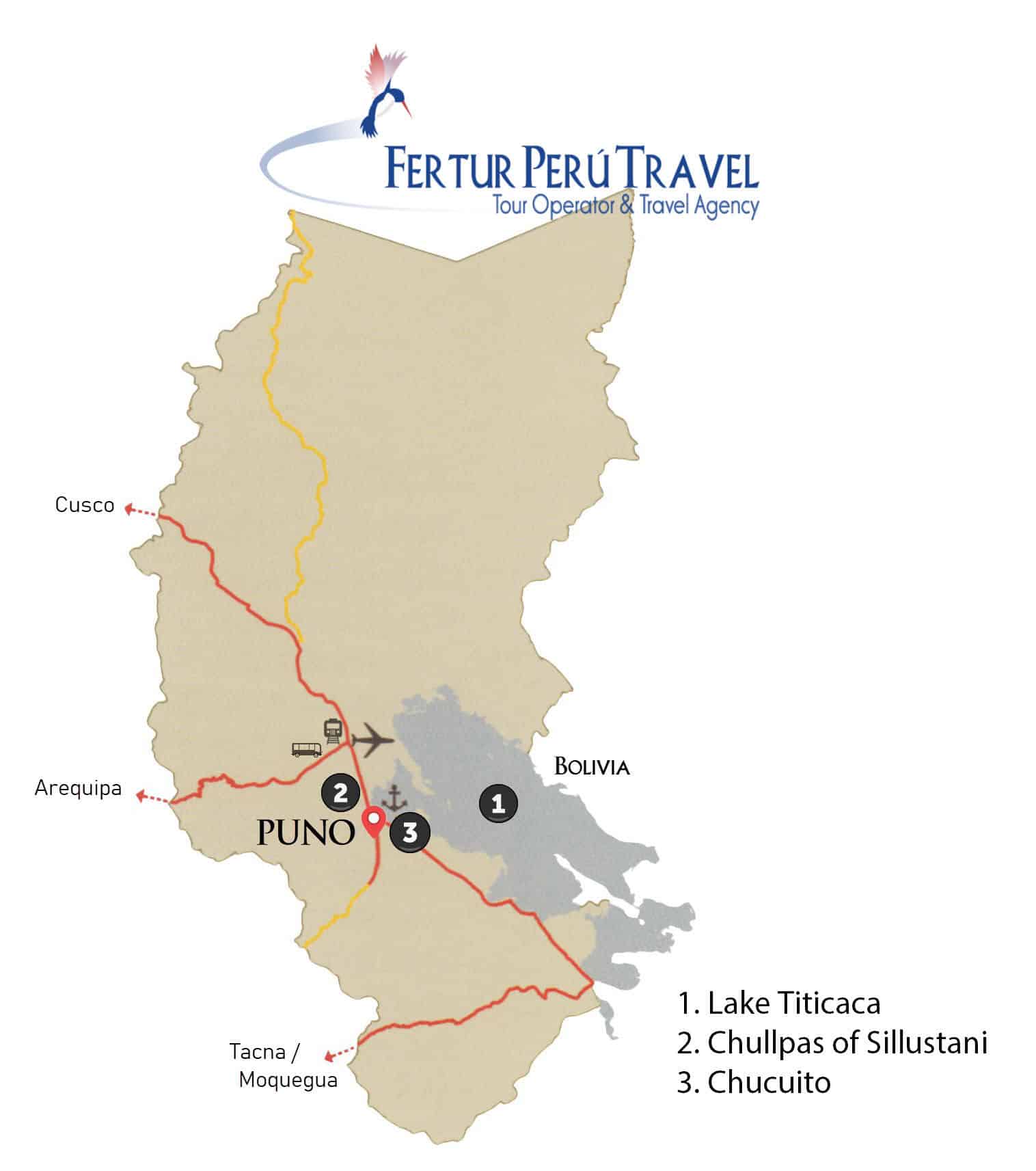
Several peninsula communities have developed excellent tourism infrastructure while maintaining their traditional character. Luquina Chico, Karina, and Ccollpa on the Chucuito Peninsula offer homestay programs with spectacular sunset views. The communities of Escallani and Ccotos provide access to lesser-visited archaeological sites alongside cultural experiences.

Planning Your Island Adventure

Each island and community offers distinct cultural experiences, landscapes, and levels of tourist infrastructure. Some provide more comfortable accommodations and easier access, while others offer more rustic, authentic experiences requiring greater adventure spirit. Working with knowledgeable local tour operators ensures you select the destinations that best match your interests, physical capabilities, and desired level of cultural engagement.

These alternative destinations not only diversify your Lake Titicaca experience but also distribute tourism benefits more widely across the region’s communities, supporting sustainable development while preserving the authentic character that makes each location special.

Explore Puno Tour Packages

Contact telephone numbers

Offices

cropped fertur favicon

Fertur-Travel