Stand at the rim of Quechuyuc Muyu, peer down at the central terraced monument of…

Chachapoyas Travel Guide: How to Explore Peru’s Cloud Forest Kingdom
Chachapoyas sits at 2,335 meters (7,660 ft) on the eastern flank of the Andes in Peru’s Amazonas region, where cloud forest spills down toward the Amazon basin and pre-Columbian civilizations built fortresses, cliff-side mausoleums, and ceremonial centers that the jungle has barely touched. The three headline sites alone — Kuelap, Karajía and Gocta Falls — justify a dedicated trip from Cusco or Lima. Add the Revash painted tombs, the Leymebamba mummy museum, and the Yumbilla waterfall (taller than Gocta, and a fraction of the visitors), and the region becomes one of Peru’s most compelling destinations outside the classic Inca circuit. This Chachapoyas travel guide covers how to get here, what to see, and how long you need.
Chachapoyas at a Glance
- Location: Amazonas region, northern Peru — eastern Andes at the edge of the Amazon basin
- Altitude: 2,335 m (7,660 ft) in Chachapoyas town; Kuelap fortress at ~3,000 m (9,840 ft)
- Best season: May–October (drier months, more stable roads and trails); July–August peak
- Recommended stay: 5 days minimum for headline sites; 7–10 days for a complete itinerary
- Getting there: Fly Lima–Jaén (~1.5 hrs), then 3–4 hrs by road — most reliable year-round; or seasonal direct flights Lima–Chachapoyas (~1 hr 25 min)
- Not to miss: Kuelap fortress (cable car access from Nuevo Tingo), Karajía cliff sarcophagi, Gocta Falls, Leymebamba Museum
- Also worth it: Yumbilla Falls (895.5 m / 2,938 ft — taller than Gocta, far fewer visitors), Revash painted cliff tombs

1. When to Visit Chachapoyas
The dry season runs from roughly May to October and offers the most stable conditions for exploring the region. Roads are more reliable, hiking trails drier underfoot, and the risk of weather-related closures at remote sites lower. July and August are the driest and most predictable months — also the busiest. Peruvian school holidays and international summer travel overlap in those weeks, so book accommodation, transport and guided tours four to six weeks ahead if you’re traveling then.
“Dry” is relative in a cloud forest. Morning mist is normal year-round, and brief showers can pass through on any afternoon, including in the peak of the dry season. Pack rain gear regardless of when you go.
From December to April, heavier rainfall raises the risk of landslides on unpaved mountain roads and can disrupt access to sites like Kuelap and Karajía. The tradeoff: waterfalls reach their most powerful flow, and the landscape turns intensely green. Gocta and Yumbilla are spectacular at full flow, especially if you can build some flexibility into your travel plans.
2. How to Get to Chachapoyas
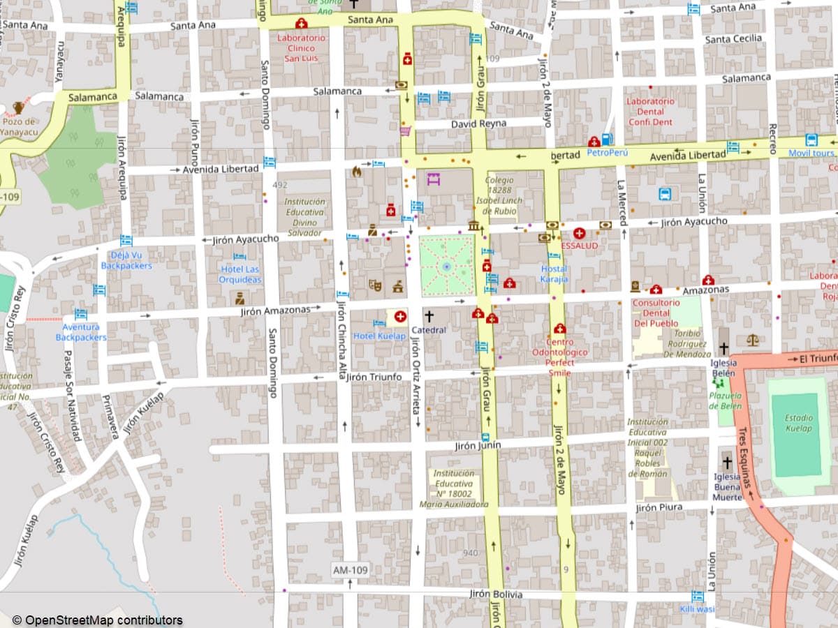
Chachapoyas — City Map
Chachapoyas is remote by design — its rugged geography helped keep ancient looters and invaders at bay, and still demands a deliberate journey today. Several gateway options exist, each with practical trade-offs.
Direct Flights to Chachapoyas (CHH)
ATSA Airlines operates seasonal non-stop flights from Lima to Chachapoyas Airport, with a flight time of about 1 hour 25–30 minutes. Recent fares have run approximately US$80–170 one-way. Schedules vary by season and demand; confirm current timetables before planning around this route, as ATSA has historically adjusted frequency.
Via Jaén (Recommended Year-Round)
LATAM and other carriers fly Lima–Jaén in about 1.5 hours, followed by a 3–4 hour road journey to Chachapoyas. This is the most consistently reliable gateway, particularly during the rainy season when cloud cover and runway conditions can disrupt flights to Chachapoyas Airport directly.
Via Tarapoto
Flying to Tarapoto works well if you’re combining the cloud forests with northern jungle experiences. The overland leg to Chachapoyas takes roughly 6–8 hours on winding but improving roads.
Via Cajamarca
Cajamarca sits within reach on a map, but the road via Celendín crosses high Andean passes and takes 8–10 hours. Scenic, and a logical choice for travelers pairing the Inca-era ruins of Cajamarca with Chachapoyas — but demanding in wet conditions.
Overland from Lima
Long-distance buses, including Movil Tours, operate the full Lima–Chachapoyas route in roughly 20–24 hours (some services extend to about 26 hours with intermediate stops). Fares generally start around US$40–60 depending on class and season. A common approach is to break the journey:
- Lima–Chiclayo–Chachapoyas: Chiclayo is around 12 hours from Lima by bus; from there, Chachapoyas is a further 8–10 hours.
- Trujillo–Chachapoyas: Buses from Trujillo reach Chachapoyas in roughly 12–14 hours — a shorter approach if you’re already on the north coast.
3. How Many Days You Need
- 4–5 days: The practical minimum for covering the three headline sites — Kuelap, Gocta Falls and Karajía — at a pace that doesn’t feel rushed. Factor in travel time between sites. None of these are quick day-trips from Chachapoyas town without very early starts.
- 7 days: Adds Revash and the Leymebamba Museum, builds in a weather buffer, and allows a more relaxed pace between hikes. A week is the framework Fertur uses for most cloud forest itineraries.
- 10+ days: Allows access to remote sites like Laguna de los Cóndores — a two-day round trip involving horses or a long hike — plus lesser-visited Chachapoya sites and time in the communities around Leymebamba and Tingo.
4. The Essential Archaeological Sites
The Chachapoyas civilization built fortresses, burial complexes and ceremonial centers across this region between roughly the 9th century AD and the Inca conquest of the 1470s. The three main sites each present a distinct face of Chachapoya culture — and each has its own dedicated guide linked below.
4a. Kuelap: The Cloud Forest Fortress
Kuelap rises on a limestone ridge at about 3,000 meters (9,840 ft), circled by defensive walls reaching roughly 20 meters (66 ft) high. The Chachapoya began construction around the 6th century AD. Most of the visible architecture dates to between approximately 900 and 1100 AD. Within the walled perimeter of several hectares, archaeologists have documented hundreds of circular stone structures and narrow funnel-like entrances designed to control access — a design feature unlike anything at comparable Andean sites of the period.
Since 2017, the Telecabinas Kuelap cable car has transformed the ascent: a journey that once required two hours by rough mountain road from Nuevo Tingo now takes about 20 minutes in the gondola, followed by a short walk to the site.
→ For current cable car status, ticket prices and visiting logistics: Kuelap: A Complete Guide to Peru’s Cloud Forest Fortress

4b. Karajía: The Cliff-Side Guardians
About 48 kilometers (30 miles) northwest of Chachapoyas, the sarcophagi of Karajía stand on a ledge high above a river gorge. These purunmachus — human-shaped funerary statues standing up to around 2.5 meters (8 ft) tall — are built from clay, ichu grass and sticks, painted white with red and yellow ochre details. Human skulls crown some of the figures, marking high-status individuals. Radiocarbon dating places the burials around the mid-15th century, near the time of the Inca expansion into Chachapoya territory.
Their inaccessible cliff location has protected them from looting. Each originally housed a mummy wrapped in mortuary textiles with accompanying offerings. To reach the viewpoint, drive roughly two hours toward Cruzpata, then take a short walk or horseback ride to the overlook.
→ For burial techniques, iconography and visiting logistics: Karajía Sarcophagi: Peru’s Cliff-Side Guardians

4c. Revash and the Leymebamba Museum
South of Chachapoyas, the Revash mausoleums present a different Chachapoya funerary tradition — collective cliff tombs built to resemble miniature villages, with multiple chambers in pink and cream-painted stone. Access involves driving to villages such as Yerbabuena or San Bartolo, then a hiking trail to the viewpoint.

Further along the valley, the Leymebamba Museum houses hundreds of mummies recovered from cliffside tombs above Laguna de los Cóndores in the late 1990s, along with thousands of associated artifacts: ceramics, textiles and rare surviving quipus. In climate-controlled rooms, mummy bundles wrapped in textiles sit alongside skeletal remains in fetal positions — one of the most significant collections of pre-Columbian burial material in South America.
5. The Waterfalls
5a. Gocta Falls
Gocta remained largely unknown outside local communities until the early 2000s, when German researcher Stefan Ziemendorff documented its height for international scientific audiences. Official measurements place the waterfall at about 771 meters (2,530 ft) across two main tiers, putting it among the tallest in the world by most counting conventions.

The reason local villagers kept Gocta quiet for so long: a popular legend holds that a blonde mermaid guards treasure in the pool at the base, and that anyone who reveals the waterfall’s location will be cursed. The swirling water at the bottom is said to resemble flowing hair. The legend persisted across generations. Villagers in Cocachimba describe it as genuine cautionary tale, not mere folklore.
Two main trails reach the falls. The route from Cocachimba covers roughly 5–6 kilometers (3–4 miles) each way and takes about 2–3 hours, with a community entrance fee collected at the trailhead. A longer circuit between San Pablo and Cocachimba gives views of both the upper and lower tiers. Horses can be hired on either route.
→ For route details, safety notes and full logistics: Gocta Falls: A Guide to One of the World’s Tallest Waterfalls
5b. Yumbilla and the Hidden Cascades
Yumbilla, near the village of Cuispes roughly 60–65 kilometers (37–40 miles) from Chachapoyas, has been measured by Peru’s National Geographic Institute (IGN) at 895.5 meters (2,938 ft) — making it taller than Gocta and among the top five waterfalls in the world by height, yet it receives only a fraction of Gocta’s visitors. The trail from the trailhead near Cuispes is relatively gentle, passing smaller cascades including Medio Cerro and Cristal through community-managed forest. A modest entrance fee supports local tourism at the trailhead.
With additional days, Gocta and Yumbilla can be combined into a single waterfall-focused stay with Chachapoyas town as a base.
6. The Utcubamba Valley: Landscape and Wildlife
The Utcubamba River flows north from the highlands to the Marañón River. Its valley has a warm, productive agricultural floor, while the upper basin transitions into montane forest ecosystems. The name Utcubamba is commonly linked to Quechua utkhu pampa, meaning ‘cotton plain,’ reflecting past cotton cultivation.
Cloud forest birdlife along this corridor is exceptional. Trails near the waterfalls and forest fragments host the Andean Cock-of-the-Rock, Emerald Toucanets, Golden-headed Quetzals, and a range of tanagers and hummingbirds. The Marvelous Spatuletail hummingbird, endemic to a small area of northern Peru, has been recorded in the broader region. Serious birders can extend itineraries to focus on this corridor, which sits within one of the most species-rich stretches of the eastern Andes.
7. Who Were the Chachapoyas?
The Chachapoyas were a pre-Columbian Andean civilization that flourished in northern Peru’s cloud forests from roughly the 9th century AD until the Inca conquest of the 1470s — one of the last major independent cultures absorbed into the Inca empire before the Spanish arrived.
At their height, the Chachapoya population may have numbered in the hundreds of thousands, organized into loosely unified regional polities (cacicazgos) that farmed terraced fields and acted as intermediaries between Andean and Amazonian trade networks. The archaeological record shows fewer grand palaces and concentrated royal tombs than at comparable Andean sites — power appears to have been distributed among local lineages rather than consolidated in a single court, even as clear social hierarchies existed.
Their resistance to Inca expansion in the 1470s was fierce. They fought from hilltop strongholds including Kuelap before eventually being absorbed. Many Chachapoya groups were then forcibly relocated to other parts of the empire — the Inca’s standard pacification strategy for recently conquered peoples who might rebel. Genetic and cultural studies indicate that distinct local lineages persisted in the northern highlands even after relocation.
After the Spanish arrived in the 1530s, epidemic disease, forced labor and political upheaval collapsed the population. By the early colonial period, the original Chachapoya language had been lost almost entirely, along with many cultural practices. What survives — the cliff tombs, the circular stone structures, the quipus now in Leymebamba — is largely what the environment preserved.
8. Living Culture and Community Tourism
Modern communities in the Chachapoyas and Utcubamba valleys maintain connections to this history in practical, ongoing ways. Artisans in Leymebamba, Huancas and surrounding towns work with textiles, ceramics and wood using techniques passed down through generations — including brightly colored cloths with animal motifs that recall styles found in Inca-era textiles.
Community-based tourism projects near the waterfall trailheads and archaeological sites offer homestays, guided hikes and cultural visits. Traveling with a responsible operator channels part of your visit costs directly into conservation and community income — an increasingly important factor for sites like Gocta and Kuelap, where visitor impact is actively managed.
9. Food: Amazonian-Andean Cuisine
Regional food reflects the valley’s position between Andes and Amazon.
- Juane — rice stuffed with chicken or pork, hard-boiled egg and olives, wrapped in bijao leaves and boiled. The bijao leaf imparts a faint herbal note that distinguishes this from other Peruvian rice dishes.
- Tacacho con cecina — smoked pork served with mashed green plantains. Simple presentation; rich flavor.
- Cuy, cecina and trout — guinea pig, cured meats and fresh river trout appear on menus across the region, accompanied by cassava, rice and local sauces.
Dining in Chachapoyas has improved noticeably over the past decade, as more visitors have begun using the city as a base for exploring northern Peru. The Plaza de Armas and surrounding streets have the highest concentration of options. A few spots now focus specifically on regional recipes using local ingredients.
10. Where to Stay
In Chachapoyas Town
- Chachapoyas Backpackers Hostel Boutique — a reliable budget option with dorms and simple private rooms, Wi-Fi, hot showers, and a short walk from the Plaza de Armas.
- Hotel Dordéan Casona — a mid-range boutique in a colonial building with wooden balconies and an interior courtyard; good value for the atmosphere and central location.
- La Xalca Hotel — similar colonial character near the historic center; consistently well-reviewed for comfort and service.
Near Gocta Falls
Lodges near Cocachimba — including Gocta Andes Lodge — offer rooms facing the falls directly, an advantage for early-morning hikes before day visitors arrive. Rates and availability vary significantly by season; compare current options before booking.
In July and August, accommodations fill up quickly. Book popular Gocta-area lodges four to six weeks ahead during peak season.
11. Getting Around the Region
Chachapoyas town is compact and walkable; the Plaza de Armas, market and most restaurants are within easy reach on foot. Local taxis charge around 5 soles for rides within the city.
Minibuses and colectivos connect Chachapoyas to Leymebamba, Revash, Karajía and the Gocta trailheads, but schedules are irregular and some routes run only on certain days. Your hotel or tour operator can advise on current departure times. For remote sites like Karajía and Laguna de los Cóndores, a private vehicle or organized tour is the practical choice.
12. Guided Tours vs. Independent Travel
Guided tours: A specialist operator simplifies the considerable logistics of a region where road conditions, weather and site regulations change without notice. Guides provide historical context at Kuelap and Karajía that is not available from on-site signage alone, and manage cable car tickets, entrance fees and transport between scattered sites. Bundling these services with Fertur often costs no more than organizing them independently once you account for private transfers and time.
Independent travel: Maximum flexibility, more planning, and a workable approach for experienced South America travelers with Spanish and time to adapt. The Lima–Jaén flight plus local colectivos is a viable independent route; book accommodations and the Kuelap cable car in advance during peak season.
Plan Your Chachapoyas Journey with Fertur
Fertur Peru Travel designs and operates multi-day cloud forest itineraries combining Kuelap, Karajía, Gocta and beyond — including private guides, cable car logistics and accommodation at Gocta-facing lodges. MINCETUR-registered.
See Chachapoyas Itineraries →Chachapoyas Travel Guide Frequently Asked Questions
Is Chachapoyas worth the journey from Lima or Cusco?
Chachapoyas combines archaeological depth with a natural scale found nowhere else in Peru: a pre-Inca fortress the size of a hilltop town, cliff-side mausoleums where sculpted figures have stood for more than five centuries, and waterfalls ranked among the tallest on Earth. The journey takes longer than reaching Machu Picchu, and the infrastructure is more basic. But for travelers who value discovery over convenience, that remoteness is part of the appeal.
When is the best time to visit Chachapoyas?
The dry season from roughly May to October, with July and August offering the most stable conditions for hiking and overland travel. Cloud forest mist is present year-round even in the dry season. From December to April, heavier rainfall can disrupt access to remote sites — but Gocta (771 m / 2,530 ft) and Yumbilla (895.5 m / 2,938 ft) reach their most dramatic flow during these months.
How do I get to Chachapoyas from Lima?
The most reliable year-round route is to fly Lima to Jaén (about 1.5 hours with LATAM and others), then travel by road to Chachapoyas (3–4 hours). ATSA Airlines operates seasonal direct flights from Lima to Chachapoyas Airport (about 1 hour 25–30 minutes) when schedules permit. Long-distance buses from Lima take roughly 20–24 hours; breaking the journey with a night in Chiclayo or Trujillo is a common approach.
How many days should I spend in Chachapoyas?
Five days is the practical minimum to visit Kuelap, Gocta and Karajía without constant rushing, allowing for transit time and early starts between sites. Seven days adds Revash and the Leymebamba Museum and builds in a weather buffer — important in a cloud forest environment. Travelers interested in Laguna de los Cóndores or lesser-known sites should allow ten days or more.
What does it cost to visit the main sites?
As of 2026, budget roughly S/55–60 per adult to visit Kuélap (cable car plus the temple fortress entrance), around S/20 for the Karajía sarcophagi viewpoint, and about S/10–15 in local community fees at both Gocta (Cocachimba tourist office) and Yumbilla (Cuispes tourism association). With a pre-arranged guided tour, these fees are generally paid separately on-site, with your guide handling the transactions on your behalf. If you are traveling independently, budget approximately S/100–110 per adult in site entry costs for a full Chachapoyas itinerary covering all four locations.
What happened to the Chachapoya language?
The original Chachapoya language — distinct from Quechua and unrelated to the major language families of the Andes — was lost almost completely within a few generations of the Spanish arrival. Epidemic disease, forced labor and colonial disruption collapsed Chachapoya-speaking communities before any systematic record of the language was made. The Quechua terms woven into local place names, including “Utcubamba” (cotton plain), are often the only surviving linguistic traces of the pre-Inca culture that built Kuelap.
What to Pack for the Cloud Forest
- Rain gear — waterproof jacket and pack cover; needed in every season
- Layered clothing — moisture-wicking base layers, insulating mid-layer, waterproof outer shell; mornings are cold at altitude, afternoons can warm quickly
- Waterproof hiking boots — trails remain muddy even in the dry season
- Sun protection — hat, sunglasses, high-SPF sunscreen; UV exposure is strong on clear days at 2,335 m (7,660 ft)
- Camera with zoom lens — for distant archaeological structures (Karajía sarcophagi are visible only from the overlook) and waterfall photography
- Binoculars — valuable for both archaeology and birdwatching along the cloud forest corridor
Fertur Peru Travel has been operating in Peru since 1994 and is registered with MINCETUR, Peru’s Ministry of Foreign Trade and Tourism. This guide is updated periodically as site conditions, transport options and entrance fees change. For the most current information on Kuelap cable car operations and ticket prices, see our complete Kuelap guide.
Related Posts


Comments (0)