Peru just approved a new Machu Picchu Master Plan, setting the framework to guide management…
T’aqrachullo: The Inca Citadel Rewriting Peru’s Archaeological Map
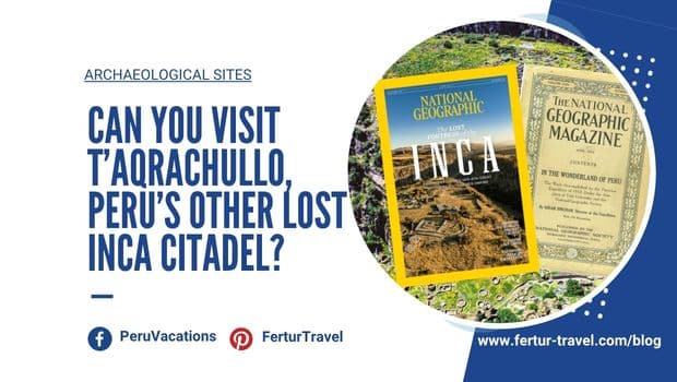
When the June 2026 issue of National Geographic reached readers, it introduced a Peruvian archaeological site that few travelers had ever heard of: a vast mountaintop citadel in the southern Andes, four times larger than Machu Picchu and tied to one of the most dramatic accounts of the Spanish conquest.
The site is T’aqrachullo, also known as María Fortaleza. It sits above the Apurímac River canyon in Espinar, Cusco — a wind-scoured mesa at 4,100 meters (13,450 ft). Peru’s Ministry of Culture opened it to visitors in December 2024 after five years of excavation and restoration. Entry is currently free.
T’aqrachullo at a Glance
- Location: Suyckutambo district, Espinar province, Cusco region — near the community of Chaupimayo
- Altitude: 4,100 m (13,450 ft)
- Size: ~43 acres (17.4 ha) — roughly four times the built area of Machu Picchu
- Occupation: c. 1400 B.C. to 16th century — Wari, Qolla and Inca periods
- Opened to visitors: December 2024
- Entry: Currently free; no advance booking required
- Getting there: 4–5 hours from Cusco to Yauri (Espinar city) by road or bus; then local transport or hired vehicle to the site
- Recommended time: Full day at the site; base in Yauri for at least two nights to allow for acclimatization
- Best season: May–October (dry season — most reliable weather and road conditions)
- Not to miss: Upper ceremonial platform, restored Wari-era fountain, chullpas on the summit plateau
1. What Is T’aqrachullo?
T’aqrachullo is a multi-period Andean archaeological complex covering roughly 43 acres (17.4 hectares), with nearly 600 documented structures across five sectors — Inca, Qolla and Wari layers stacked on a rocky mesa above the Apurímac River canyon.
T’aqrachullo sits on a rocky outcrop above the confluence of the Totorani and Apurímac rivers. Its Quechua name evokes the terrain itself: broken stone, rock formations and water channels.
By comparison, the built area of Machu Picchu is roughly 10.6 acres (4.3 hectares). T’aqrachullo is about four times larger.

Rising above the confluence of the Apurímac and Totorani rivers at over 4,100 meters, the full extent of María Fortaleza T’aqrachullo comes into focus — 17 hectares of ceremonial buildings, residential compounds, funerary structures, and ritual pathways spread across five sectors on a naturally fortified farallón, flanked on all sides by sheer canyon walls that made it one of the most strategically positioned sites in the pre-Hispanic southern Andes.
Photo Courtesy of the Dirección Desconcentrada de Cultura de Cusco
Archaeologists from Peru’s Ministry of Culture have documented nearly 600 structures across five sectors. These include dwellings, funerary towers known as chullpas, ceremonial enclosures, storage buildings, stairways, terraces and a major public-ceremonial platform at the heart of the complex.
Some areas have been restored and opened to visitors. Others remain untouched for future research.
The views are part of the experience. From the summit, river canyons cut through the highland landscape below. On clear days, snow-capped peaks appear on the horizon. The setting helps explain why the Incas and earlier Andean civilizations placed such importance on sacred geography — mountains, river confluences, stone formations and sky alignments were not scenery. They were part of the spiritual order of the world.
2. Three Thousand Years of Sacred History
Excavations document roughly 3,000 years of Andean occupation at T’aqrachullo — from the Early Horizon around 1400 B.C. through the Spanish conquest — spanning Wari, Qolla and Inca periods, each leaving distinct layers in the archaeological record.
T’aqrachullo was not only an Inca site. That is one of the reasons it matters so much.
The Wari period, roughly A.D. 540 to 900, is especially important. The Wari civilization, centered in Ayacucho, expanded across large parts of the Andes centuries before the rise of the Inca. T’aqrachullo appears to have stood near the southeastern edge of Wari influence.
In the early 1990s, archaeologist Alicia Quirita identified Wari ceramics at the site — an unusual find for the region. Later excavations strengthened that early observation. In 2023, researchers uncovered the foundations of a ceremonial temple whose earliest construction phases date back about 2,000 years.
The Wari appear to have built or modified a ceremonial fountain at the center of the upper platform. When the Incas arrived centuries later, they did not erase what came before. They built over it, adapted it and folded the older sacred landscape into their own imperial ritual system.
Inca chullpas were constructed over earlier Wari burial areas. Archaeologists also documented what appears to be a resealed Wari tomb — evidence that the Incas may have opened earlier burials, removed their contents and closed them again.
The Qolla period, between the decline of the Wari and the rise of the Inca, is also present in the archaeological record. By the time the Incas consolidated control in the 15th century, T’aqrachullo had already been considered sacred by several generations of Andean peoples.
3. Was This the Lost Shrine of Ancocagua?
The strongest historical claim surrounding T’aqrachullo links it to Ancocagua, one of the great sacred places of the Inca Empire.
In 1553, Spanish chronicler Pedro Cieza de León published his Crónica del Perú. In it, he listed five of the most important temple sites in the Inca world. Among them was Ancocagua, described as an ancient oracle rich in gold and silver, and revered by people from across the empire.
Then Ancocagua disappeared from the historical record.
For centuries, no one could say where it had been. The Spanish accounts were vague. Later chroniclers offered little help. By the late 1500s, after looting, abandonment and religious suppression, the site had faded from memory.
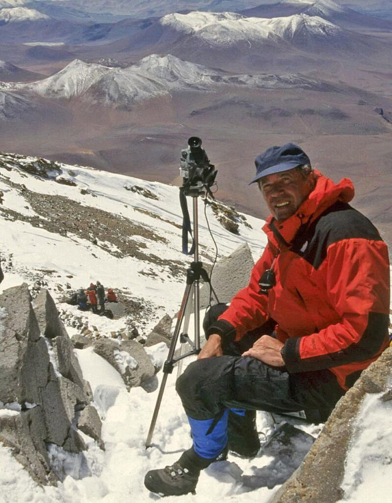
World-renowned high-altitude archaeologist Johan Reinhard spent decades trying to solve that puzzle. Beginning in the 1980s, the former National Geographic Explorer-in-Residence engaged in archival detective work.
Reinhard, most famous for discovering the Inca Ice Maiden in 1995 on Peru’s Mount Ampato, poured over colonial manuscripts, place names, river systems and community records.
A key clue came from a rediscovered section of Juan de Betanzos’ 1551 manuscript, Suma y narración de los Incas.
Betanzos, who spoke Quechua and was married to an Inca noblewoman, gave the most detailed description of Ancocagua: a fortified temple on a rocky spur, opposite a hilltop, almost inaccessible and without water on its summit.
The Spanish chronicler also related a grim account of the conquest. After the Spanish invasion, defenders at Ancocagua blocked the only path to the summit. A brother of Francisco Pizarro led a siege. The Spanish cut off food and water. Snowfall allowed the defenders to melt snow and hold out longer. When the Spaniards finally broke through, many of the Inca inhabitants leaped from the cliffs rather than surrender.
Reinhard narrowed the likely location to the area south of Coporaque, in what was historically Hatun Canas — today’s Espinar province.
In 1994, Alicia Quirita took him to T’aqrachullo. The site matched the description: a rocky mesa, a narrow access route, cliffs on several sides and no natural water source on the summit.
In 1998, Reinhard published his argument in Andean Past, identifying T’aqrachullo as the lost shrine of Ancocagua. At the time, the theory received little attention in Peru. Quirita herself remained cautious. Emerson Pereyra, the archaeologist who later led the Ministry of Culture excavations, had not heard of the theory when he was assigned to the project.
The excavations would change that.
4. The Gold Find That Shifted the Story
In September 2022, archaeologist Dante Huallpayunca was working in a stone enclosure in Sector B when a glint of gold appeared in the soil.
What emerged was remarkable: nearly 3,000 sequins of gold, silver and copper. These tiny circular plates had once adorned ceremonial garments worn by Inca elites. They had remained buried for about 500 years.
The find forced archaeologists to reassess the importance of the site.

Neither Machu Picchu in 1911, nor the Lost Inca Fortress of T’aqrachullo now, were ever truly “lost” so much as misplaced and misunderstood. The difference today is that skilled archaeologists can now prove what the Spanish chronicles and local memory always held.
Pereyra, who had spent 12 years excavating at Machu Picchu before coming to T’aqrachullo, has said he had never seen anything at Machu Picchu comparable to what the team found here.
The sequins were only part of the story. Subsequent excavations revealed a ceremonial temple, gold nuggets set into stonework, finely made llama figurines, and sheets of chrysocolla — a blue-green mineral — shaped into pumas.
Archaeologists also found evidence of violence. Stone projectiles, obsidian spearheads and human remains with traumatic injuries were documented across the site. The Ministry of Culture’s analysis indicates conflict over multiple periods, not only during the Spanish siege but also in earlier phases of occupation.
One striking feature is the rockfall blocking the main stairway to the plateau. What once looked natural may have been deliberate — possibly caused by the site’s Inca residents to prevent Spanish access to the upper complex.
Among the most sobering discoveries was a secondary multiple burial containing the remains of 84 individuals. The full story of that burial is still being studied.

Sector C is the site’s most densely occupied funerary zone, with over 100 mapped structures — chullpas, cistas, and fosas — distributed across the rugged farallón. The white outlines trace each structure as recorded by archaeologists, revealing a landscape that functioned as a vast open-air necropolis spanning the Middle and Late Horizons.
Photo Courtesy of the Dirección Desconcentrada de Cultura de Cusco
Researchers also recovered more than 100 illas and conopas, small ceremonial objects associated with fertility, abundance, protection and ritual life in the Andes.
When Reinhard returned to T’aqrachullo with Quirita in November 2025 — their first joint visit since 1994 — the evidence was far stronger than it had been three decades earlier. Quirita, who had long been cautious about the Ancocagua theory, reportedly acknowledged what the archaeology now made difficult to deny: the evidence was there.
5. What Visitors See Today
The Ministry of Culture has restored about 300 structures and opened parts of T’aqrachullo to visitors.
The visit begins in the lower sector, known as Sector A. This area includes circular and semicircular structures, a large rectangular hall or kallanca, and a standing stone or huanca with sacred associations. It gives visitors a first sense of the site’s scale and daily function.

Sector A forms the main entrance to the site, where a cobbled path winds through the canyon past a sacred huanca standing stone and a kallanka hall set on an andén platform — the first threshold visitors crossed into María Fortaleza T’aqrachullo.
Photo Courtesy of the Dirección Desconcentrada de Cultura de Cusco
From there, a steep stairway climbs toward the upper plateau. This ascent is central to the experience. It is also physically demanding, especially at more than 4,100 meters (13,450 ft) above sea level.

At the boundary of Sectors A and E, a zigzagging stone stairway cuts between massive boulders — the sole formal access point to the upper sectors of the fortress. Associated with a sacred huanca, this passage was both a practical thoroughfare and a ritual threshold controlling entry to the ceremonial and funerary zones above.
Photo Courtesy of the Dirección Desconcentrada de Cultura de Cusco
The upper sectors contain the most impressive ceremonial architecture: the restored fountain, the central platform, chullpas rising against the sky, and enclosed ceremonial spaces where Inca nobility likely gathered for ritual observances.

Sector B’s Edificio Público-Ceremonial crowns the upper farallón with its unmistakable oval-ended perimeter wall, enclosing a two-part ceremonial hall, a fine-masonry fountain, and restricted inner chambers — the political and ritual heart of the fortress.
Photo Courtesy of the Dirección Desconcentrada de Cultura de Cusco
Sector D remains unexcavated and is reserved for future research.
This is not a site to rush. The altitude, the climb and the scale of the ruins all call for a slower pace.
6. How to Visit T’aqrachullo
T’aqrachullo is located near the community of Chaupimayo, in the district of Suyckutambo, province of Espinar.
The most practical base is Yauri, also known as Espinar city. From Cusco, the drive to Yauri takes roughly four to five hours, depending on road conditions. Bus service connects Cusco with Yauri. From there, travelers need local transport or a hired vehicle to reach Suyckutambo and the archaeological site.
This is not yet a polished visitor experience. That should shape expectations.
There are no extensive facilities on site. Rural roads can be slow. Weather can change quickly. The altitude is serious. Travelers should be acclimatized before attempting the visit, ideally after spending at least two or three days in Cusco.
Good walking shoes, layered clothing, water, sun protection and a realistic sense of your own fitness are essential.
Entry is currently free and no advance booking is required. That may change as the site receives more international attention.
7. When to Go
The dry season, from May through October, offers the most reliable weather and the clearest views.
The rainy season, from November through April, brings greener landscapes but also more difficult road conditions. In heavy rain, access can become challenging.
For most travelers, the dry season is the better choice.
8. What to Combine With T’aqrachullo
Espinar remains far less visited than Cusco’s classic archaeological circuit, but it holds enormous promise for travelers interested in Andean history.
Nearby sites include Mauccallacta and Kanamarca, both of which can be worked into a broader route through this lesser-known part of the Cusco region.
A multi-day itinerary makes far more sense than a rushed day trip. It allows time for altitude adjustment, local context and a deeper understanding of why this landscape mattered across so many centuries.
9. Why T’aqrachullo Matters
It would be easy to tell the T’aqrachullo story only as a tale of a “lost city,” ancient gold and dramatic rediscovery. That story is real. It is also incomplete.
What makes T’aqrachullo especially important is that its excavation, documentation and restoration have been led by Peruvian researchers.
Emerson Pereyra and his team carried out the fieldwork. Alicia Quirita, who grew up near the site and spoke Quechua at home, helped place it on the archaeological map years before the international headlines.
In January 2025, Peru’s Ministry of Culture published María Fortaleza T’aqrachullo: Investigación, Restauración y Puesta en Valor — Resultados y Nuevos Aportes Culturales, a 278-page technical study edited by Emerson Pereyra Pacheco compiling the full results of more than five years of excavation, restoration and conservation work at the site.
“It covers all aspects of the research and restoration of the architectural structures, the numerous discoveries, their uses and functions, and all the information related to the peoples who built them,” Pereyra said.
The surrounding communities have always known this landscape. Their children played among the ruins. Their families used the area as pastureland. Their stories, names and memories remained tied to the mesa long before the rest of the world began paying attention.
Tourism now brings income, visibility and recognition to Espinar. But it must be handled carefully. T’aqrachullo is not only an archaeological attraction. It is part of a living cultural landscape.
Visitors should approach it with respect, patience and curiosity.
10. FAQs About Visiting T’aqrachullo – María Fortaleza
Is T’aqrachullo worth visiting?
T’aqrachullo offers something almost impossible to find anywhere else in Peru: a major Inca sacred site — now confirmed as one of the empire’s most important oracle temples — at the moment it is entering public awareness, before infrastructure, crowds or entrance fees reshape the experience. The site is four times larger than Machu Picchu, archaeologically richer than it first appeared, and set in a landscape of genuine drama. Yes, it is worth it — provided you come prepared for high altitude, rural transport and a visit without the comforts of Peru’s established circuit.
How much time do I need at T’aqrachullo?
Plan for a full day at the site itself — the altitude (4,100 m / 13,450 ft), the climb to the upper sectors, and the scale of nearly 600 documented structures all require a slower pace than most visitors expect. Most travelers will want to base in Yauri (Espinar city) for at least two nights: one before the site visit to acclimatize, one after. Adding nearby sites such as Mauccallacta and Kanamarca turns this into a three- to four-day excursion from Cusco.
How do I get to T’aqrachullo from Cusco?
The most practical route is to travel from Cusco to Yauri (also called Espinar city), roughly four to five hours by road depending on conditions. Bus service connects Cusco with Yauri. From Yauri, travelers need a hired vehicle or local transport to reach Suyckutambo district and the site near Chaupimayo. The roads are rural — a 4WD vehicle is advisable. Fertur Peru Travel can arrange transport and a guided visit as part of a broader southern Cusco itinerary.
Is T’aqrachullo really larger than Machu Picchu?
Yes. The archaeological complex at T’aqrachullo covers approximately 43 acres (17.4 hectares). The built area of Machu Picchu is roughly 10.6 acres (4.3 hectares). T’aqrachullo is about four times larger in area and has nearly 600 documented structures across five sectors. The scale of the site is one of the first things visitors notice on arrival.
What does it cost to enter T’aqrachullo?
Entry is currently free, and no advance booking is required. That may change as the site receives more international attention following the June 2026 National Geographic feature. Confirm current conditions before you travel.
Do I need a guide to visit T’aqrachullo?
A guide is not currently required, but one is strongly recommended. The site is large, the archaeological context is complex and the altitude is serious. A knowledgeable guide can explain the connections between Wari, Qolla and Inca occupation layers, point out details — such as the location of the gold sequin find and the resealed Wari tomb — that are easy to miss, and help manage the physical demands of the visit. Local guides from the Espinar area are the best option; Fertur Peru Travel can arrange this as part of a Cusco-based itinerary.
What is the connection between T’aqrachullo and the lost oracle of Ancocagua?
Ancocagua was listed by 16th-century Spanish chronicler Pedro Cieza de León as one of the five most important temple sites in the Inca Empire — an oracle rich in gold and silver, revered across the empire — before vanishing from the historical record entirely.
High-altitude archaeologist Johan Reinhard spent decades tracing the site through colonial manuscripts, place names and river geography, and in 1998 published his identification of T’aqrachullo as Ancocagua’s likely location in the journal Andean Past.
The 2019–2024 Ministry of Culture excavations — which recovered nearly 3,000 gold, silver and copper sequins, gold nuggets set into stonework, and evidence of a major Inca ceremonial complex — substantially strengthened the case. When Reinhard and archaeologist Alicia Quirita returned together in November 2025, Quirita, who had long remained cautious about the identification, reportedly found the accumulated evidence difficult to deny.
Plan Your Visit With Fertur Peru Travel
T’aqrachullo is not yet a standard stop on a Peru itinerary. Reaching it independently requires planning around rural transport, altitude, timing and limited visitor infrastructure.
Fertur Peru Travel can arrange a guided visit from Cusco or include T’aqrachullo as part of a broader southern Peru itinerary. We work with knowledgeable local guides who can explain the archaeology, the landscape and the living Andean traditions connected to this remarkable site.
For travelers who have already seen Peru’s classic highlights and want to go deeper, T’aqrachullo offers something rare: a major archaeological site at the moment it is entering the wider public imagination.
That window will not stay open forever.
Contact Fertur Peru Travel to begin planning your visit to T’aqrachullo and Espinar.
Sources for this article include the National Geographic feature “Inside the search for the lost citadel of the Inca” (June 2026 issue; published online May 2026), Johan Reinhard’s 1998 academic paper “The Temple of Blindness: An Investigation of the Inca Shrine of Ancocagua” in Andean Past, the Ministry of Culture publication María Fortaleza T’aqrachullo: Investigación, Restauración y Puesta en Valor — Resultados y Nuevos Aportes Culturales (January 2025), and reporting by El Comercio Peru and Agencia Andina.

Related Posts
Comments (0)